
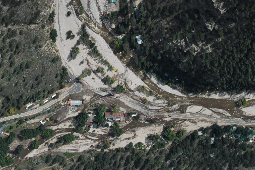
Aerial view of a mountainous area with damaged roads and buildings caused by flooding; mud and debris cover parts of the landscape, with some trees and houses remaining—an urgent challenge for Colorado engineering teams.

It has become a high priority for several states including Colorado to identify fluvial hazard zones (FHZ) as a part of their long-term river corridor planning. During the 2013 Colorado flood, about half of the private structure damages occurred outside the FEMA designated Special Flood Hazard Areas (SFHA) partly due to river fluvial processes such as channel erosion, deposition and lateral migration.

Therefore, the Colorado Water Conservation Board (CWCB) is currently performing a pilot FHZ study based on Colorado Senate Bill 15-245 to identify fluvial hazard zones for the pilot study areas and develop regulatory methodology, criteria and guidelines for FHZ mapping. Information about CWCB fluvial hazard mapping could be obtained from http://coloradohazardmapping.com/hazardMapping/fluvialMapping. Additional information is provided in the FHZ fact sheet.


Blog Categories
Share Article:

Recent Posts

Text on water background reads: From vision to reality. Exploring the feasibility & design of a whitewater park. Logos at bottom: we ♥ water and Calibre. Blue and yellow color scheme.
September 21, 2026

From “This River Has Potential” to a Park You Can Paddle Seeing a river’s potential...

Text on a blue water background reads: Every whitewater park starts with a Champion. Below are the words we♥water and the Calibre logo.
September 10, 2026

Whitewater parks don’t start with a master plan. They start with a champion. And sometimes...

August 17, 2026

Flood and swiftwater emergencies demand more than technical knowledge. They require responders to make decisions,...